02 February 2024
![]() 22 mins Read
22 mins Read
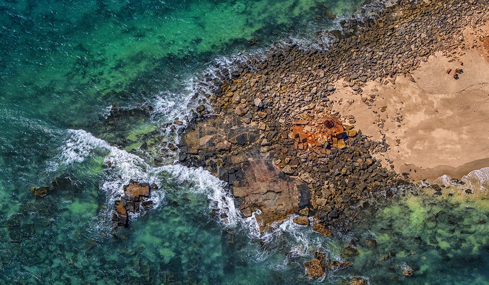
Where does the bush stop and the outback start? This is a much debated question in Australia, without a definitive answer it seems. And maybe that’s a good thing. Much more than just a geographic definition that can be plotted on a map (if it was, popular belief is that it would cover up to 70 per cent of the country), ‘the Outback’ holds a spiritual place in our collective experience of being Australian.
No matter how big you believe it actually is (or isn’t), there is certainly a wealth to see out there; here are plenty of ideas of amazing to wander and wonder at.
Victoria and Tasmania get short shrift when it comes to staking claim to a patch of outback to call their own and, while there’s probably nothing to be done for Tassie, there’s a slice of Victoria that’s definitely in with a chance. Little Desert National Park in western Victoria totals 132,647 hectares of land stretching from the Wimmera River to the border of South Australia.
Home to the Wotjobaluk people, the park boasts an arid landscape that bursts into bloom in late winter to early summer; hiking, star gazing and camping along the Wimmera River (known to the locals as Barringgi Gadyin) are drawcards here. The park tag teams with the nearby town of Dimboola to attract visitors, with its mesmerising pink lake; the colour is deeper and lasts longer during hot and dry weather, so plan to see it at its bubblegum best in the late summer months.
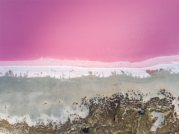
Dimboola’s mesmerising pink lake.
Located on Western Australia’s Coral Coast – also known more evocatively as the Outback Coast – get the full visual impact of where the outback meets the sea at François Peron National Park, 52,500 hectares of scrubland and red sand that dissolve into startling green and blue at its edges; it’s a ‘best of both worlds’ picture that encapsulates our dual national focus (being in the outback and being by the water).
Take a priveleged glimpse at how the water and sand come together in swirling, ethereal patterns on a scenic flight with a local operator such as Shark Bay Aviation.
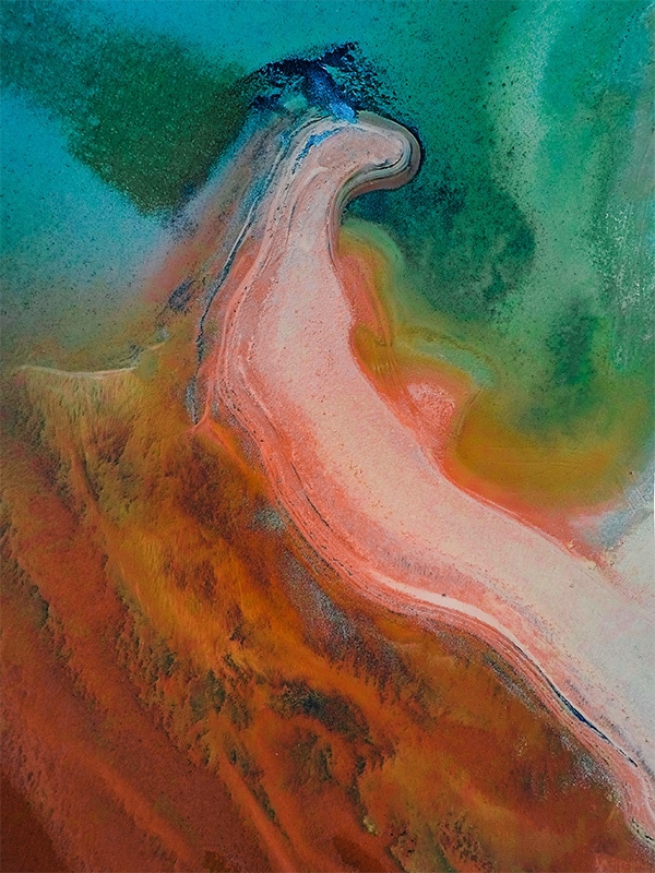
Shark Bay is where the red sands of the outback meet the Indian Ocean.
A drawcard to the Central Wheatbelt of Western Australia’s ‘Golden Outback’, Wave Rock’s sinuous curves were formed a staggering 2700 million years ago, with water erosion and weathering moulding the original granite cliff into a 14-metre-high, 110-metre-long stone wave permanently ready to break over the surrounding landscape.
But wondering at this awesome configuration is just one reason to make the 336-kilometre journey from Perth: visit from late August to early October to see a staggering 12,000 varieties of wildflowers paint the wheatbelt landscape in kaleidoscope hues; check out Australia’s Golden Outback for a handy Wave Rock Wildflower Trail planner so you don’t miss a bloom.
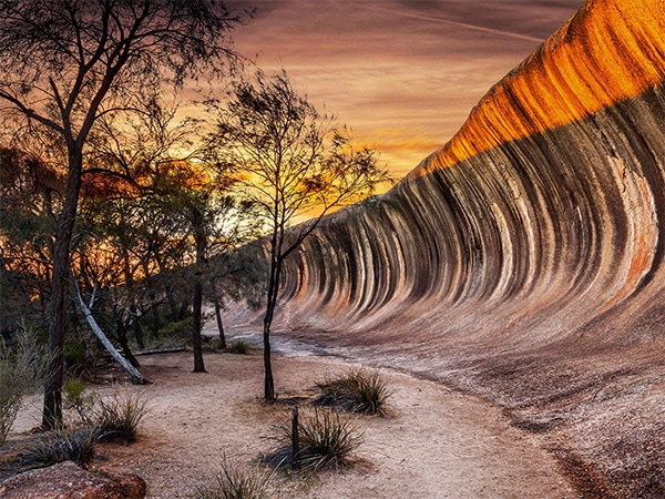
Be engulfed in wildflowers at Wave Rock.
There are endless reasons that Kakadu and Arnhem Land in the Northern Territory are unique and mesmerising propositions, from the wildlife to the landscapes.
In fact, all their brilliance cannot be contained in just four seasons, so they have six: Kudjewk, monsoon season from December to March; Bangkerreng, known as ‘Knock ’em Down’ storm season in April; Yekke from May to mid-June when the weather is cooler and less humid; Wurrkeng, the coldest part of the year from mid-June to mid-August; Kurrung, when the weather is hot and dry, mid-August to mid-October; and Kunumeleng, pre-monsoon season when the humidity builds, from mid-October to late December.
With so much detail, it is easy to decide that Yekke is the perfect time to visit to see the rock art at Injalak Hill. A few minutes’ drive from Gunbalanya in West Arnhem Land, the area is home to Kunwinjku people who have been painting the rock shelters here for millennia, including in the arresting ‘x-ray’ style.
Tour with a local guide, leaving from the Injalak Arts Centre; permits to visit need to be organised in advance via the Northern Land Council or an operator like Outback Spirit or Lords Safaris.
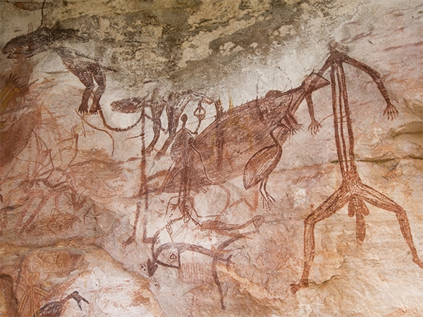
See rock art on Injalak Hill.
More than just an event, the Karijini Experience is an immersion in the country and culture of the Banjima people of the central Pilbara in Western Australia.
Held during April, the itinerary of events allow visitors to interact with the landscape of Karijini National Park in surprising ways, through food (try the bush tucker high tea), art, music and traditions (including the free Welcome to Country ceremony).
You can fly there (Paraburdoo Airport is the closest at 140 kilometres from Karijini National Park) or the 1250 kilometre coastal drive from Perth takes in Exmouth and the exquisite Ningaloo Reef (inland it’s 1400 kilometres).
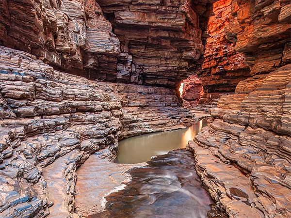
Experience Karijini.
So you like to go walking? Well, have we got a hike for you: The Heysen Trail. The 1200-kilometre walk snakes its way from Cape Jervis on the South Australian coast, passing through the Fleurieu Peninsula and Mt Lofty Ranges, the Adelaide Hills and the Barossa Valley (leave room in your pack to squeeze in a bottle of the Barossa’s best to take with you).
Walkers then take in the stunning expanse of Wilpena Pound in Flinders Ranges National Park, before finally reaching the end of the trail some 60 days later at the ruggedly remote Parachilna Gorge in the heart of the outback. If you don’t have the time or the inclination to do the full two-month trek, the trail has been designed so that sections can be done as short walks. The trail is closed from December to April, so plan a winter walk and get yourself a good pair of boots.
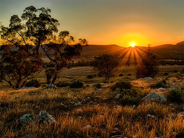
Walk the Heysen Trail in the Flinders Ranges.
The epic journey across the Nullarbor (‘no tree’ in Latin) is an attraction in its own right, but it becomes even more compelling during the months of July and August each year. That’s when the dramatic 200-kilometre-long Bunda Cliffs (the longest line of sea cliffs in the world) become a prime vantage point for viewing the majestic southern right whales as they frolic and calve in the waters below.
You can camp overnight at one of the campsites on the cliffs, which are located between The Head of Bight and the border of Western Australia; the night skies are almost as amazing as the whale watching during the day so look up before you bed down.
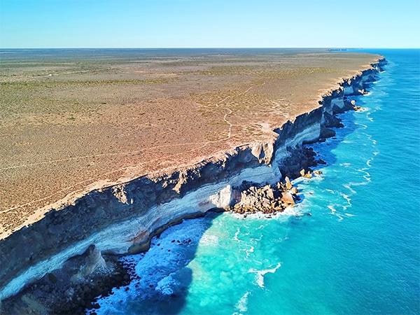
Bunda Cliffs are the longest line of sea cliffs in the world.
Located in Tjoritja/West MacDonnell National Park, 135 kilometres west of Alice Springs, Ormiston Gorge is indeed a pretty gorgeous proposition. Its landscape of scrubby greens contrasted with rich, red rocks is intoxicating to traverse (there are easy walks; some with wheelchair access), but it is the area around its waterhole that presents an outback oasis in vivid colour.
Just 500 metres’ walk from the visitor centre, the water is a blissful salve to the outback heat and there’s even a sandy outback beach on which to loll as the afternoon shadows dance on the surrounding rock faces.
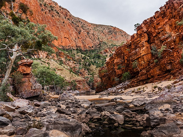
Go wild swimming at Ormiston Gorge.
Doing the Gibb River Road has become the stuff of folklore; travelling its length is a journey that some spend a lifetime planning. But there are easier and just as amazing journeys in the Kimberley, in the far northern reaches of Western Australia, that don’t require you to check out of your life for weeks (or months) on end.
Like the one out of Broome to Windjana Gorge: it’s roughly two hours from Broome to Derby and then another two into the 2000-hectare Windjana Gorge National Park. It’s almost day trip material! It’s best visited from May to September when the cooler weather makes walking much more pleasant, all the better to see fruit bats, birdlife and the freshwater crocs that gather in the rock pools around Bandingan Rock. You can go in for a swim, but it’s at your own risk.
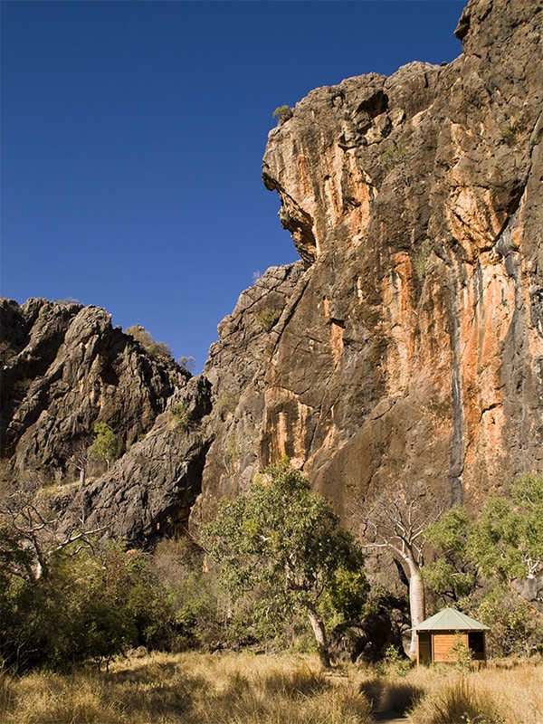
Day trip to remote Windjana Gorge.
Arguably the crowning glory of Queensland’s outback experience in Gulf Savannah country is cruising the still waters of Cobbold Gorge, surrounded by the noisy silence to be found when deeply engulfed in nature. Located in Far North Queensland and easily accessible by road, Cobbold Gorge is the state’s youngest gorge: the foundations were laid 1700 million years ago, but movement some 10,000 years ago resulted in the formation of the gorge as it is today, hence its teenager status.
There are various tours and experiences to be had, but for our money a helicopter flyover is the way to go. The best time to visit the gorge is April to late October to avoid the humidity and summer heat; if you are in the vicinity from September to November, take the opportunity to continue on to Burketown (it’s just under 12 hours’ drive) to see the amazing Morning Glory cloud formations. Known as kangólgi to the local Aboriginal people, the phenomenon involves long lines of tube-like clouds forming over the Gulf of Carpentaria in the early morning; charters flights are available for viewing.
It’s hard to imagine that anything could be more arresting than seeing Broome’s Roebuck Bay on a clear blue-sky day, as the red sand and sparkling waters merge at the edge of the country, but the bay at night might just top it.
From March to November each year for a few days a month, when the tide is low and a full moon starts its ascent, the Staircase to the Moon appears. The result of the moon’s reflection hitting the exposed mudflats to create the appearance of a ladder stretching to the base of the moon, the otherworldly optical illusion is best viewed from Town Beach.
Grab a bite from one of the stalls at the Staircase to the Moon markets, which appear here when the staircase does, and settle for the show.
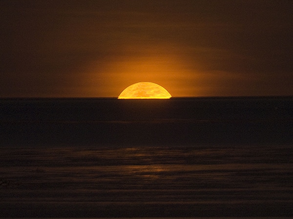
Broome’s Roebuck Bay.
Located in the far west of New South Wales near Broken Hill, Mutawintji National Park is not a name that instantly springs to mind but more’s the pity. Dominated by the red rocks of the Bynguano Range, the land is home to the Malyankapa and Pandjikali people, who have held it sacred for thousands of years.
As a result, the park boasts some stunning rock art sites: Thaaklatjika is an easily accessible walk and offers up paintings and engravings that depict life here both pre- and post-European settlement.
There’s every chance you will see plenty of wildlife along the way – wallabies, emus and birds – and once the sun is finished warming the rocks and red gums and slinks into night, stick around to see the inky night sky scattered like confetti with stars; the campground at Homestead Creek has amenities (toilet and showers) and barbecue facilities. Visit during spring to see it at its best.
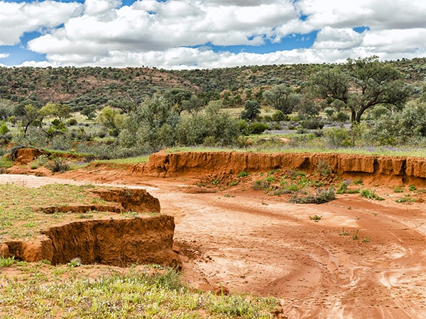
Sleep under an outback sky at Mutawintji National Park.
The Kimberley region of Western Australia is all but cemented at the top of most Australians’ travel bucket list.
It’s an intoxicating ochre-tinged landscape of ranges, gorges, savannahs and dust that melts into the water along its edges; exploration in these parts is done on a grand scale.
Epic overland journeys along the 660-kilometre Gibb River Road take in wondrous sights rendered by nature over millennia, and resound with tales of the Indigenous Australians who have respectfully dwelt here for tens of thousands of years.
Navigating its coastline is an equally gargantuan task, if not a more luxurious one thanks to the exclusive collection of cruise companies that ply the waters here. There are roughly 1000 islands in the Buccaneer Archipelago alone, as well as the Horizontal Falls, King George Falls and Cape Leveque (pictured), where the red rocks of the outback meet the clear, cool waters of the Indian Ocean.
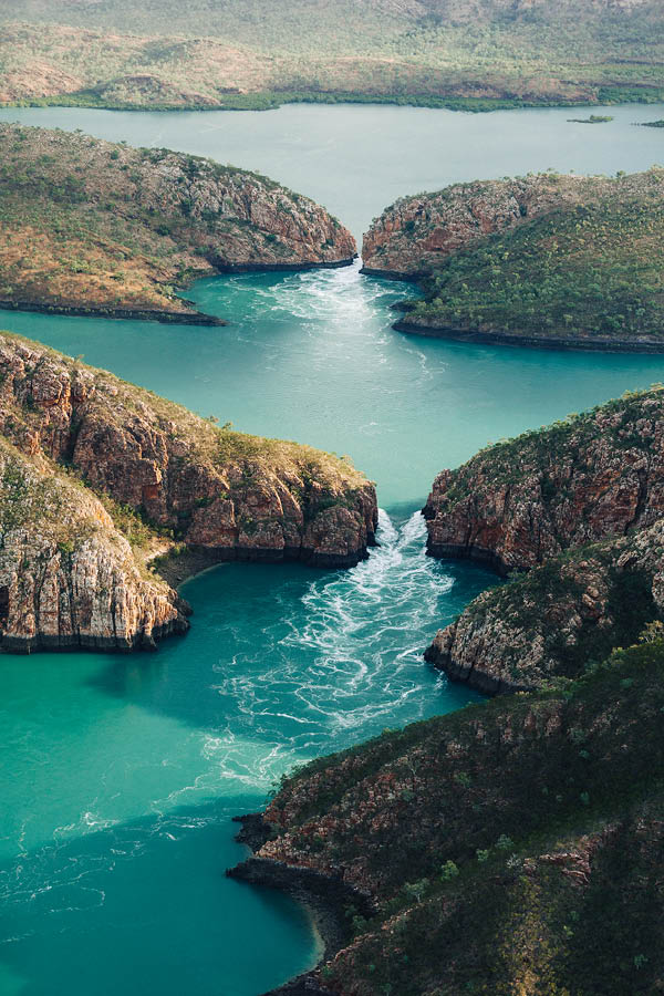
Fly over the stunning horizontal waterfall of The Kimberleys. (Image: Brook James)
This spectacular biennial, three-day festival draws the people of the Cape to the town of Laura to exchange and pass on history through song and dance.
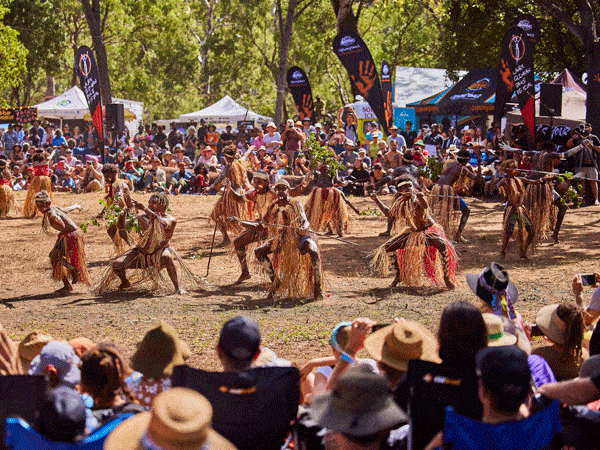
The Laura Dance Festival attracts large crowds in Queensland. (Image: Tourism and Events Queensland)
Over 10 nights Alice Springs is illuminated with light installations designed by Aboriginal artists and projected against the imposing MacDonnell Ranges.

Watch Alice Springs light up at Parrtjima. (Image: Tourism NT/Daniel Tran)
Meaning ‘meeting together’ in the Anangu language, this four-day festival, held in April at Ayers Rock Resort, features traditional and contemporary live music, an art market, bush tucker and more.
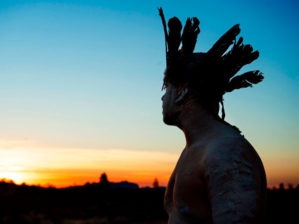
Tjungu translates to ‘meeting together’ in the Anangu language. (Image: Voyages Indigenous Tourism Australia)
With over 70 Indigenous-owned community art centres in attendance, this annual event gives visitors the chance to purchase artwork directly from artists and their communities. There’s also traditional dance and music.
Australia’s Aboriginal rock art is some of the most stunning in the world, and it is in plentiful supply too.
There are a staggering 100,000 known rock art sites across the country, some estimated to date back 40,000 years. In Kakadu National Park head to Nourlangie to see creation ancestors including Namarrgon, the Lightning Man, and to Ubirr to marvel at the depiction of a thylacine, also known as the Tasmanian tiger, which became extinct on the mainland 2000-3000 years ago.

Nourlangie in Kakadu National Park features ancient Indigenous rock art. (Image: Tourism NT/Sean Scott)
See x-ray art (paintings depicting the skeletal frames of animals and humans) in Nitmiluk National Park. In the Kimberley, find Wandjina, on of the most significant creation spirits, and the elongated Gwion Gwion figures at King Edward River Crossing.
And head to the Queensland town of Laura to see Quinkan rock art on the sandstone escarpments there. For a true insight into the traditions and legends of rock art, book a tour with a local Indigenous tour operator whenever possible.

Discover the ancient Quinkan rock art in Laura. (Image: Tourism and Events Queensland)
Known as Burringurrah in the local Wajarri language, Mount Augustus, located in Western Australia’s Mount Augustus National Park, often plays second fiddle to that other hulking rock formation in the Northern Territory.

Mount Augustus is known as Burringurrah in the local Wajarri language. (Image: Tourism Western Australia)
But the mountain island is actually bigger than its neighbour Uluru. Made up of sand and gravel deposited by an ancient river system that drained the region some 1600 million years ago, its imposing form is surrounded by arid scrub.

The sun catches on Mount Augustus. (Image: Tourism Western Australia)
You can drive around it on a 49-kilometre loop to get a better idea of its breadth, or the climb to the summit takes up to eight hours and requires a high level of fitness. There are a range of shorter walks requiring moderate fitness, none of which compromise on spectacular scenery or the feeling of blissful remove from the modern world.
Located in the heart of Queensland’s Gulf Savannah region, Cobbold Gorge is something of a secret treasure. For the ultimate way to connect with the quiet beauty of the gorge and its surroundings try stand-up paddle boarding through it.

Stand-up paddle boarding through Cobbold Gorge. (Image: Tourism and Events Queensland)
Within Nitmiluk National Park in the Northern Territory, this is a series of 13 sandstone gorges that stretches along the Katherine River; cruise its waters and explore the park on one of its walking trails.

Nitmilukfeatures 13 sandstone gorges. (Image: Tourism NT/Tourism Australia)
Head to Queensland’s Carnarvon National Park to see the Art Gallery, a significant Indigenous art site, and walk the 87-kilometre Carnarvon Great Walk, taking in soaring cliffs and sandstone escarpments.

Cool off in the blue waters of Carnarvon Gorge. (Image: Tourism and Events Queensland)
West of Alice Springs in the Tjoritja/West MacDonnell National Park, Ormiston is resplendent with towering walls and abundant wildlife. Swim its cool waters or walk the Ormiston Pound Walk.

Ormiston Gorge is an outback treasure. (Image: Tourism NT/Salty Aura)
Stretching some 5600 kilometres from Jandowae in Queensland’s Darling Downs, passing through Cameron Corner (where the borders of Queensland, New South Wales and South Australia meet) and finishing at the Great Australian Bight in South Australia, the Dingo Fence (now known as the Wild Dog Barrier Fence) holds the distinction of being the world’s longest fence.

The Digno Fence holds the title of world’s longest fence. (Image: Greg Snell)
Originally constructed in the 1880s to ward off rabbits, it was converted in the 1940s to protect sheep in the south from dingoes in the north. You can get close to the fence in various locations in Queensland and South Australia, but since much of it crosses private land, travelling along its entirety isn’t possible.
Australia has more than 500 national parks, covering a staggering 28 million hectares of land.
While they blanket a diverse array of landscapes, from rainforest to bush to coastline, some of the headlining parks in the country can be found in the outback. The most instantly recognisable would have to be Uluru-Kata Tjuta National Park, home to arguably the most famous monolith in the world, the glorious Uluru, but while you are in the Northern Territory head to the slightly more low-key Finke Gorge National Park out of Alice Springs, with its oasis-like Palm Valley of 3000 adult trees and countless juveniles.

Escarpments in Ikara-Flinders Ranges National Park ref;ect the sunset. (Image: Laszlo Bilki)
In South Australia, Ikara-Flinders Ranges National Park covers 95,000 hectares and wows visitors with mountains, gorges and abundant wildlife. And in New South Wales, the luminous Mungo National Park presents a lunar landscape that takes on an impossibly beautiful glow as day surrenders to night.
With the exception of Antarctica, Australia is the driest continent on the planet (it’s actually the driest populated continent on Earth), with 18 per cent of the mainland area being classed as desert.

The Simpson Desert colours the landscape in orange and red. (Image: Tourism NT/Steve Strike)
While most people know about the Simpson and the Great Sandy deserts, Australia actually has a total of 10 deserts to explore, all imbued with an arid beauty that belies the harsh conditions found there. They are also teeming with life, populated as they are by the likes of lizards, birds, kangaroos, dingo and camels (introduced and now considered a pest). Here, the deserts in order of size.
1. Great Victoria Desert in WA and SA
2. Great Sandy Desert in WA and the NT
3. Tanami Desert in WA and the NT
4. Simpson Desert in the NT, Qld and SA
5. Gibson Desert in WA
6. Little Sandy Desert in WA
7. Strzelecki Desert in SA, Qld and NSW
8. Sturt Stony Desert in SA, Qld and NSW
9. Tirari Desert in SA
10. Pedirka Desert in SA
In a national park renowned for its stunning natural beauty (Ikara-Flinders Ranges National Park), Wilpena Pound stands out in its surroundings. The massive amphitheatre of mountains, a traditional meeting place for the Adnyamathanha people, Wilpena is often talked of as one of the most spectacular of all outback sites.
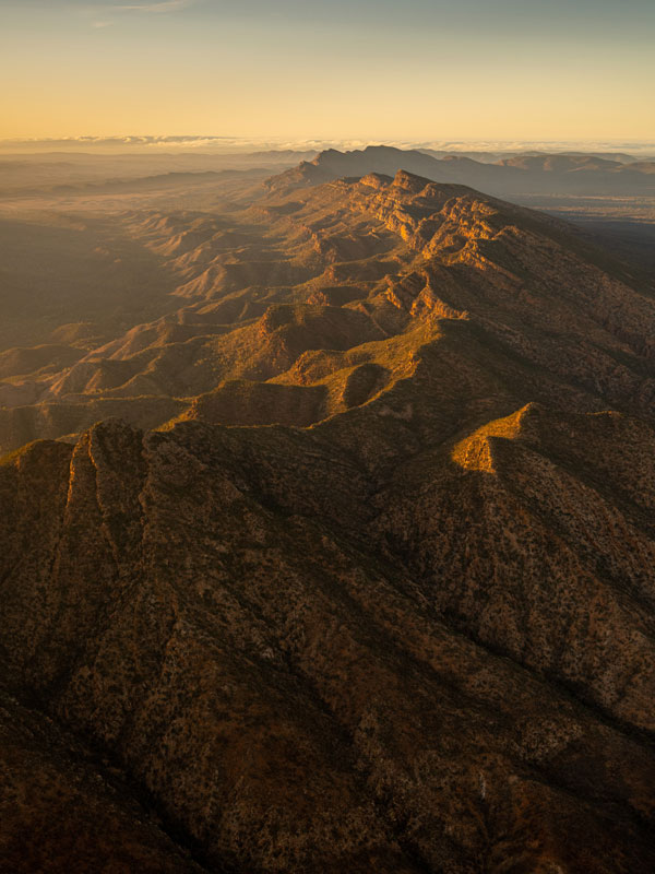
Fly over Wilpena Pound for a bird’s-eye view. (Image: heidi who photos)
There are three quintessential ways to experience it: take a scenic flight over its wide expanse, gazing down at the clear, proud outline it imposes on the surrounding landscape; book a cultural tour conducted by an Aboriginal guide; or stay in the gracious surroundings of Wilpena Pound Resort, the only accommodation located within the park.

Wipena Pound at sunset. (Image: South Australian Tourism Commission/Adam Bruzzone)
Click here to discover more Wilpena Pound
Also known as Botany Bay Greens, this leafy vegetable is native to Australia and New Zealand. Packed with vitamin C, it was one of the first native ingredients to be adopted into the diet of European settlers who used it to fight scurvy.

the edible warrigal greens grow wild across Australia.
A member of the sandalwood family, the quandong grows in arid and semi-arid areas of the country. Sweet and tangy, the fruit can be stewed, dried or eaten as is; full of vitamin C, it is also a cure-all, reportedly good for treating toothache.
With its green leaves and clusters of soft, fluffy yellow flowers, lemon myrtle is as pretty as it is tasty. One of the most widely used native ingredients, its leaves can be infused into oils for dressing salads and into dairy-based desserts or dried and added to spice mixes.

Lemon Myrtle can be used as an ingredient in salads and desserts.
Native to south-east Queensland, especially around Bunya Mountains National Park, the bunya tree only bears fruit once it reaches 100 years in age, and then crops every two to three years. The nuts are found inside soccer ball-sized cones and can be eaten raw, roasted or milled into flour.
Looking like a stretched lime, this year-round fruit is filled with caviar-like bubbles that literally pop with citrus flavour. High in vitamin C, Indigenous Australians have used them for medicinal purposes for thousands of years; the pulp and juice can be used as an antiseptic.

Finger limes grow all-year round.
Growing naturally in New South Wales, Victoria and Tasmania, as the name suggests this native produces small peppercorns that have a slightly sweet taste with a peppery kick in the tail.
One of the most curious of bush tucker ingredients, found in the Northern Territory and Far North Queensland, these little insects have a green tinge and a fruity citrus taste; dried they can be added to spice mixes or sprinkled on ice-cream.
Located within Purnululu National Park in the Kimberley region of Western Australia, the spectacular Bungle Bungle Range (or the Bungle Bungles as they are simply known to most) was formed an estimated 350 millions years ago, and has been known to its Aboriginal custodians for tens of thousands of years.

Purnululu National Park is World Heritage Listed. (Image: Tourism Western Australia)
So it is mind-blowing to think that most people only found out about it in 1983 when a film crew documented its rugged beauty. Today the whimsical World Heritage-listed beehive rock formations are one of the most popular attractions in the Kimberley, rising 250 metres above the surrounding landscape.

The magical Bungle Bungle Ranges rise 250 metres into the sky. (Image: Tourism Western Australia)
The best way to get a true idea of its awe-inspiring scale (and wonder at how it stayed hidden from view for so long) is to take a helicopter flight over it.
Click here to discover more on The Bungle Bungles
Acknowledged as Australia’s last true wilderness, Arnhem Land is located in the Top End of the Northern Territory, a location that finds itself blessed with an array of pristine landscapes, from rugged coastline to remote islands to rainforest.

Arnhem Land is traditionally owned by the Yolngu people. (Image: Tourism NT)
The traditional owners, the Yolngu people, have dwelt here for roughly 50,000 years, living off the land and observing traditions passed down not just from generation to generation but through millennia. The best way to visit is on an organised tour as permits are required from the Northern Land Council and the Dhimurru Aboriginal Corporatio to visit this spiritual land.

Arnhem Land is known as Australia’s last true wilderness. (Image: Tourism NT/Rachel Stewart)
This mining city in the far west of New South Wales boasts heritage buildings, the Living Desert sculpture site and, nearby in Silverton, the Mad Max Museum, celebrating Mad Max 2, which was filmed in the area.

Broken Hill is quintessentially outback. (Image: Tourism Australia)
Located in Central West Queensland, Longreach is viewed by many as the ultimate outback town, home to the Qantas Founders Museum and the Australian Stockman’s Hall of Fame.
Meaning ‘meeting of big waters’ in the local Indigenous language, the town was established in 1961 as a service centre for the Ord River irrigation scheme. It is now an important stop for travellers exploring the Kimberley.
Known as the opal capital of the world, the South Australian mining town of Coober Pedy typifies the outback spirit: in a bid to beat the harsh conditions here most residents live underground; stay at the Desert Cave Hotel.

Coober Pedy is known as the opal capital of the world. (Image: South Australian Tourism Commission)
This Queensland town is writ large in outback folklore; visit to see Big Red, the tallest sand dune in the Simpson Desert; take in the annual race meeting; and to see the Burke and Wills Dig Tree.

Looking out over Alice Springs at sunset. (Image: Tourism Australia)
No list of outback towns can ignore Alice, located in the heart of the Red Centre. The vibrant town boasts natural wonders in the form of the Larapinta Trail and the MacDonnell Ranges and an indefatigable spirit.
LEAVE YOUR COMMENT